City to host public forum on new fire hazard map
Fire and emergency officials to explain fire hazard zone updates
– Paso Robles Fire & Emergency Services and the Building Department will host a public forum on March 31 at 6 p.m. in the Council Chamber at 1000 Spring Street to discuss the adoption of the Fire Hazard Severity Zone Local Responsibility Area map for the city.
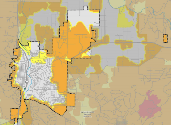
The map was developed by CAL FIRE in accordance with legislation requiring each jurisdiction to adopt its respective map and an ordinance, as outlined in Government Codes 51179 and 51177(e).
The public information session will provide an opportunity for residents and developers to learn about the mapping details, required adoption timelines, and how the changes may affect future projects.
The Local Responsibility Area map can be viewed on the city’s website at the LRA Fire Hazard Severity Zone Map page. Specific property ratings can be checked using CAL FIRE’s viewer at calfire-forestry.maps.arcgis.com or calfire-umb05.azurewebsites.net.
Comments or questions can be directed to crr@prcity.com.