
Clearer skies in the forecast after over a week of rain
– Clearer skies are in the forecast again for Paso Robles starting tomorrow, according to Weather Underground. Trace amounts of rainfall are in the forecast today, expected to total around .08-inches. Another chance of trace amounts of rainfall is in the forecast Wednesday night. Overall, this week’s forecast is fairly sunny, a welcome reprieve from the last week of rain that has caused havoc in North County and across the state:
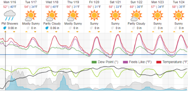
Click here to view a 10-day forecast on Weather Underground.
Schools in San Luis Obispo County are operating as usual this week.
So far, just from reported losses from government agencies, the estimated losses and response costs stand at $46-million dollars, according to the county.
Wind advisory
A wind advisory remains in effect until 9 a.m. today, according to the National Weather Service. Areas under advisory include the Central Coast of San Luis Obispo and Santa Barbara Counties and interior San Luis Obispo County. Expect south winds of 15 to 25 mph with gusts of 40mph.
 Road closures
 Road closures
Numerous roads and bridges remained closed throughout San Luis Obispo County. See the county’s updated map here for details.
North River Road from Union to Wellsona roads remains closed in Paso Robles. See the city’s updated map here for details.
Chimney Rock
There are people who chose to stay in their homes near Lake Nacimiento and are unable to leave their neighborhood due to the road closure at Chimney Rock Road outside Paso Robles, according to the County of San Luis Obispo Public Works Department. The eroding ground surrounding the culvert below the road surface has made the road unsafe. However, public works crews and contractors have been working 24 hours a day and have managed to temporarily rebuild the road. Inspectors are making sure the temporary repair is safe for limited vehicle traffic.
In addition to the Chimney Rock closure, there are many other roads that are closed due to unsafe conditions. You can find the list and map at readyslo.org at this link: Road Closures – San Luis Obispo County (emergencyslo.org). Citizens are reminded not to travel past road-closed signs. A road can appear safe on the surface and be degrading underneath the asphalt. There are a few closures that have left residents isolated. In the case of medical need, the county can conduct an emergency transport to a health-care facility.
Salinas River level
The Salinas River level is currently at 17.5 feet, according to the National Weather Service. Measurements of the river are taken near the 13th Street Bridge. Click here to view current levels.
Lake levels
 Lake levels
Lake Nacimiento is at 76% capacity and Lake San Antonio is at 27% capacity as of Friday. Click here to view current local lake levels.
Search for Kyle Doan
The search for 5-year-old Kyle Doan who was swept away by rising flood waters were suspended over the weekend due to weather and the speed of the water flow in the search area. Search and rescue crews have remobilized and resuming the search:
Power outages
PG&E is still responding and repairing damage from earlier storms, but most areas with outages have had their power restored. For the latest outages, estimates of repair, and safety information regarding outages, visit PGE.com.

The spillway at Lake Nacimiento. Photo by Ron Scott.
Water releases from Nacimiento Reservoir increase slowly for public safety
Extremely small water releases from Nacimiento Reservoir into the Salinas River that have been on-going through the series of current winter storms are required for safe operations. The current releases increased slowly from Friday overnight to Saturday to reduce the risk of the reservoir spilling over as a result of the next series of storms in our area.
During the recent storms, reservoir levels dramatically increased from 27% to 76% since Dec. 31, 2022. Approximately 183,000 acre-feet of water were captured and not released into the river, significantly reducing flood impacts throughout the Salinas Valley. However, at this point, minimal flood control releases must commence, according to the County of Monterey. “It is healthy for the system to release small amounts of water now, versus waiting and having to release larger amounts of water later,” said District 3 Supervisor Chris Lopez.
“It is not safe to keep the flood pool (the term used to describe the upper capacity of the reservoir) full,” said County of Monterey County Administrative Officer Sonia M. De La Rosa. “With the recent weather, now is the best time to begin this normal operational procedure.” During the current storm events, the fractional releases from the reservoir were 60 cubic feet per second, compared to the flood-stage flow of the river which was well over 40,000 cubic feet per second. The small reservoir releases will increase to 350 cubic feet per second, and then slowly increase to under 4,000 cubic feet per second for about a week.
County experts are timing the releases to complement the lower river levels at the south end of the valley. And, because it takes three to five days for water to travel from the Nacimiento Reservoir to Spreckels, the current river flood levels at that location will have passed. “The releases that are being initiated will follow the lower flows in the river. Our conservation pool will be full through this weather event and will be available for releases during the dry months. Such measures are highly beneficial for groundwater recharge and diversions to the Castroville Seawater Intrusion Project,” said Certified Floodplain Manager & Operations Manager for the Monterey County Water Resources Agency Shaunna Murray.
More information about current reservoir release and storage data can be found on the Monterey County Water Resources Agency’s website, mcwater.info.