
New Times: Proposed changes to groundwater basin boundaries draw anger
Map courtesy Of SLO County
SLO New Times reports:
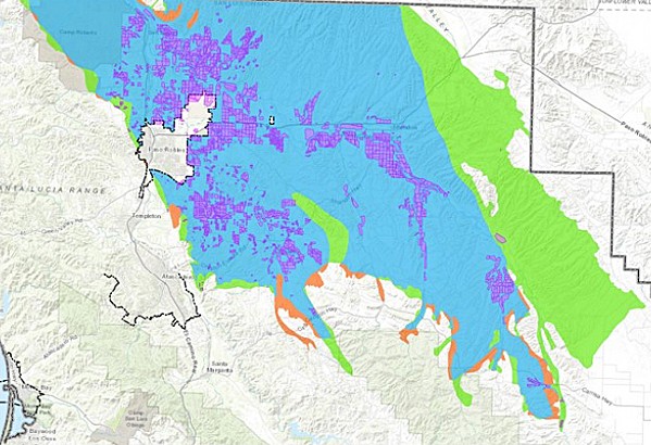
–After seven years of water restrictions over the Paso Robles Groundwater Basin, San Luis Obispo County is redrawing the basin’s boundaries, which will subject hundreds of new property owners to a moratorium on irrigating and other rules.
The revised map is part of a package of changes to the county ordinance that regulates the 684-square-mile aquifer in North County. Passed in 2013 amid an ongoing drought, the ordinance was recently extended to 2022 to buy time for the Paso Groundwater Sustainability Plan—which is currently being reviewed by the state—to get implemented.
When the Board of Supervisors approved the extension in December 2019, it also authorized county staff to update the boundaries, review and redefine the “areas of severe decline,” and develop a voluntary fallowing program.
But all of those changes received blowback from landowners and farmers at a June 11 county Planning Commission meeting. The new map—which is being updated to mirror the state’s map—brings 524 new property owners into the boundaries of the basin and removes 244. It adds significant acreage to the basin’s east, past Shandon, as well as some properties west of Paso Robles and Templeton and around Creston.