
Storms cause flooding, knock out power

More rain in the forecast today
– Paso Robles measured .06 inches of rain on Saturday, .7 inches on Sunday, and .90 Monday morning. The rainfall season total is 12.98 inches.
On Sunday, intense winds swept through San Luis Obispo County, causing widespread power outages affecting tens of thousands of residents. The powerful winds knocked down trees and power poles across the region.
Amidst the storm on Sunday, the San Luis Obispo County Regional Airport lost power. However, the airport remained fully operational as it switched to generators to keep the terminal running.
As a result of the adverse weather conditions, travel in the area has become hazardous due to downed trees, power lines, and the risk of falling rocks. Authorities advise caution for those who need to drive, emphasizing the potential dangers on the roads.
Residents are urged to contact 9-1-1 only in the case of a life-threatening emergency.
Cal Fire San Luis Obispo Unit crews were able to rescue a man caught in high waters this afternoon in Nipomo, according to a social media post:
A flood watch remains in effect through Tuesday afternoon for San Luis Obispo, Santa Barbara, and Ventura Counties. The ongoing risk of flooding is attributed to excessive rainfall, with dangerous and life-threatening flooding anticipated. Extensive roadway flooding is likely, and significant debris flows may occur in and around recent burn scars. Creeks and streams are at risk of overflowing, and mainstem rivers could experience significant flooding.
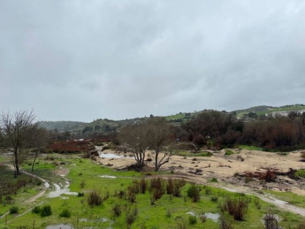
The Salinas River in Paso Robles behind Khol’s.
Furthermore, mountain and canyon roadways may face extensive rock and mudslide activity, potentially causing substantial travel delays and road closures.
The current weather pattern is influenced by a strong and wet storm system moving across Southwest California through Tuesday. The heaviest rain is expected through Monday, with rainfall totals ranging from three to six inches. Areas facing south and southwest could see six to 12 inches, with rainfall rates of 0.50 to 1.00 inch per hour during the peak of the event. Localized higher rates are probable near thunderstorms and upslope areas. The prolonged duration of heavier rainfall is likely to result in unusually high three to six-hour rain totals.
For more information and safety guidelines, residents are encouraged to visit http://www.weather.gov/safety/flood.