
More rain on the way, schools reopen, lake levels rise, roads still closed
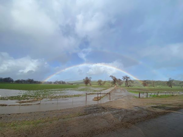
Photo by Alberto Reyes of Paso Robles.
Salinas River water level has fallen to 22 feet
– A break in the storms will provide a short respite for Paso Robles today and tomorrow, but more rain is in the forecast starting Friday once again, according to Weather Underground.
Click here to view a 10-day forecast for Paso Robles.

Paso Robles received .32 inches of rain inches in the past 24 hours. The current seasonal rainfall total is 16.06 inches. Click here to view the Paso Robles Rainfall Totals page.
The National Weather Service reports the Salinas River water level has fallen from a peak of 32 feet early Monday morning to 22 feet as of this morning.

Lake Nacimiento filling up. Photo by Marc Coons.
The storms delivered fresh water to local lakes. Lake Nacimiento’s water level rose to 69% with a maximum depth of 162 feet. A week ago it was at 34%. Lake San Antonio rose from 12% to 22% over the same period.

Road closures
The city of Paso Robles opened more roads on Tuesday, including the 13th Street Bridge. Roads still closed include South River Road between 13th Street and Navajo Avenue near Albertsons, North River Road from Union to Wellsona roads, 21st Street between Pine Street and Riverside Avenue, and Vine Street between 22nd and 24th streets.

Closures in Paso Robles as of 6:30 a.m. Wednesday. Closures are marked in red, re-openings in green; black denotes city limits. Follow the latest city road closures here.
Highway 101 has reopened in both directions in Paso Robles, according to reports.
The County of San Luis Obispo Public Works Department says it is working to reopen closed roads with particular attention to reopening roadways where residents have no alternate route away from their homes.

Airport Road at the Estrella River Crossing. Photo was taken Tuesday around noon by Richard Mason.
As of 2 p.m. Tuesday, there were 40 posted road closures on county-maintained roads, four of those isolating approximately 100 homes. Isolated residents are in the Redondo, Chimney Rock, San Luisito Creek, and Upper Lopez Canyon areas.
Public works crews are responding to emergencies from ongoing storms, as well as preparing for the next set of storms coming, including inspecting culverts and road conditions.
- To report a road hazard (i.e.: flooding, downed tree) on a county road, call (805) 781-5252
or submit a request via web notifications at: https://www.slocounty.ca.gov/Departments/Public-Works/Contact-Us.aspx - Call 911 for all emergencies.
- For current county road closures, go to: https://www.slocounty.ca.gov/Departments/Public-Works/Services/Maps/Road-Closures-and-Delays.aspx

Current storm-related road closures in SLO County as of 6 a.m. Click here to view an interactive map.
School campuses re-open
Paso Robles Unified School District campuses have all reopened today.
The Cal Poly campus will reopen Wednesday, Jan. 11. All operations will resume. There are still several impacts to the campus, Cal Poly reports. The following roadways are closed to non-essential operations:
• Sports Complex Road as well as the entire Sports Complex is currently closed.
• Mt. Bishop Road is closed.
• Poly Canyon Road is closed at Village Drive.
• Stenner Creek Road is closed east of the train trestle.
Community Foundation activates its disaster support fund
Yesterday The Community Foundation San Luis Obispo County activated its disaster support fund to begin accepting donations in response to the storms, floods, and associated damages in our region. Funds are needed in order to meet the needs of individuals as they arise and to deploy resources where they are most needed.
100% of all contributions to the fund will go directly to agencies working on the ground to support people in need. Individuals are encouraged to donate at https://www.cfsloco.org/donate/?fund=3894.
Related: